
The Interspect Ltd. primarily produces aerial ortho image maps by RGB, MS or HS remote sensing and develops airborne instruments.
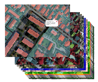
Multispectral orthophoto mosaics
The digital aerial multispectral sensors capture images not only in spectral range perceptible to human eye (RGB electro optical images), but, beyond the visible light, it also records other types of electromagnetic waves. The images of various spectral attributes enable the detection of different phenomena.
.jpg)
The RGB and the color near infrared composites of the multispectral aerial othophoto map made by the Interspect IS 3 digital sensor with a thermal infrared layer
Aerial Maps in the Near-Infrared Range (NIR)
Segment of a multispectral aerial map with RGB and near-infrared bands (INTERSPECT IS 3 system, 2011, taken from manned fix- wing aircraft)
Radiation that is invisible to the human eye can be fixed with electro-optical way as the light. The Interspect aerial remote sensing instruments capture sharp and detailed images in the spectral range of 380-1700 nm. The multispectral systems are able to capture the ultraviolet, the RGB and the near-infrared range. The images of different spectrum provide several interpretation opportunities and methods.
.jpg)
Bands of the Interspect IS 3 digital sensor that resemble the colors of classical KODAK CIR aerial film. The differences of reflectance is clearly discernible.
Applications:
- Surveying plant diseases and contaminated areas
- Pesticides and nutrients controlled dispatch
- Forestry and urban management
- Forest damage
- Soil science and water management mapping
...
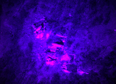
The color UV composite shows rock formations in a forest
The details of the process
- Assessing the User needs
- Mission Planning
- Authorization
- Aerial survey with direct georeferencing
- Refinement & control geodetic survey
- Image processing (ortho-rectification and mosaicking)
- The projection, the file format and the tiling are chosen by the customer
- Evaluation and online GIS (if necessary)
Image interpretation and database construction
- Evaluation of remotely sensed images
- Database construction
- Expertise